Archive Record
Images
Additional Images [2]
Metadata
Title |
Port Et Barre D'Amelia 1778 |
Object Name |
Map |
Scope & Content |
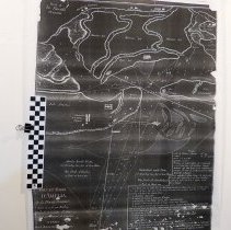
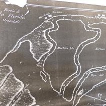
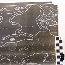
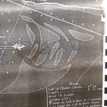
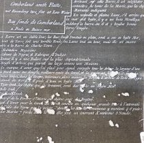
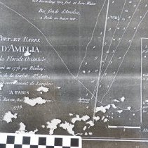
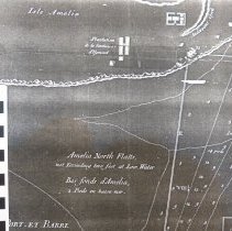
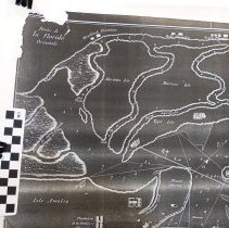
4 copies of a 1778 French map " Port Et Barre D'Amelia". This is an exact copy of Jacob Blamey's ( Master of His Majesty's Schooner, St John ) survey of January 1775. Not to scale. Provides Soundings (accurate?) and sailing instructions. Provides possible anchor points. Lists plantations belonging to: Earl of Egmont on Amelia Island and Bell's, Ralph's, Woodland's, and Wright's in Georgia. The map shows the ruins of Fort William at the southern tip of Cumberland Island, 2 copies 15.5 X 22", 1 - 10.5 X 14 " , 1 - 11 X 14". See also same basic maps: 2009.016.001 1977.001.1340 2017.059.152 |
Object ID |
2014.028.001 |
Collection |
AIMH |
Caption |
Port Et Barre D'Amelia 1778 |
Number of images |
8 |
People |
Bell Perceval, John (Earl of Egmont) Ralph Woodland Wright Blamey, Jacob |
Search Terms |
Egmont Plantation Woodlands Plantation Bells Plantation St. Marys River Amelia River Mount Misery Tiger Island Fort William Old Town Fernandina Morrisses Bluff Amelia North Flats Cumberland South Flats |
Subjects |
Maps |
Date |
1778 |