Archive Record
Images
Metadata
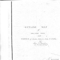
Title |
Survey of Nassau Neck |
Object Name |
Survey, Land |
Scope & Content |
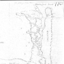
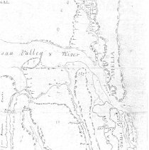
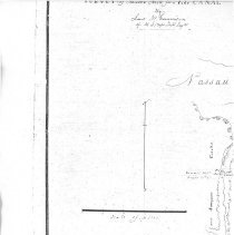
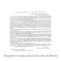
This is a copy of a survey map held by The National Archives, Record Group No. 77, Civil Works Map File U.S. 374-115 /4. The map shows the southern end of Cumberland at the north and the St Johns River to the south. The survey was conducted by J. W. Gunnison. "Wandering In Camden: Historical Sketches of Camden County, Georgia and Beyond" by Eloise Bailey Thompson, River City Printing 2008 says "[Gunnison] was transferred to the Corps of Topographical Engineers. In November 1839, he was reassigned to St. Marys to superintend improvements on the inland waterway between the mouths of the St. Johns and St. Marys rivers. The deepening of the inland passage had first been proposed in 1828, when Congress appropriated $13,500 for the purpose." While in St Marys he met Martha Deloney who was to become his wife. A location on modern maps called Gunnison Cut is named for him but not indicated on this map. See Vertical Files Biography- J. W. Gunnison for additional information. The following is an email from National Park Service Ranger Joshua Salestrom regarding Gunnison's Cut. Salestrom, Joshua Attachments Fri, May 31, 8:25 AM to Morgan, Daniel, Emily, Jayne The Federal government spent $78,000 between 1828 and 1838 to dredge and straighten meandering portions of the Amelia River and Sisters Creek to better facilitate travel and commerce by boat. Two substantial cuts were made to straighten the route: Kingsley's Cut (interesting) on the Amelia River, located "3 or 4 miles south of Fernandina,", and Gunnison's Cut on Sisters Creek, "4.5 miles south of Nassau Sound." I've attached a screen grab of Gunnison's Cut. I've seen no direct evidence that Kingsley Plantation slaves were used for the project, however, in my opinion it is entirely plausible, as they would likely have been the largest labor pool in the vicinity. It'll certainly make for an interesting research project in the future. By 1879, Gunnison's cut shoaled to two feet in depth at low water. $7,000 was appropriated for dredging and by June of 1881, 2,057 feet of Gunnison's Cut was dredged to a depth of five feet at low water. 8,634 cubic yards of material was removed and deposited along the banks of the cut (See attachment). Hope this helps. I'm sure there is much more we can learn about this. -Josh |
Object ID |
2019.010.001 |
Collection |
AIMH |
Caption |
Nassau Neck upper left |
Number of images |
5 |
People |
Delony, Martha Gunnison, John W. |
Search Terms |
Bell River Clapboard Creek Dane Point Dunn Creek Fitzpatrick Creek Fort George Gunnison Cut Inland Pass Kingsley Cut Lighthouse Little Talbot Nassau Neck Nassau River Nassau River Valley O'Neil Creek Pilot Island Pumpkin Creek Sampsons Creek Sisters Oyster Bed St. Johns River St. Johns Valley and River Tiger Island |
Date |
1839 |