Archive Record
Images
Additional Images [5]
Metadata
Title |
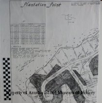
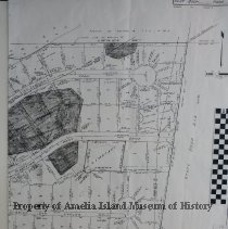
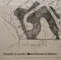
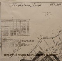
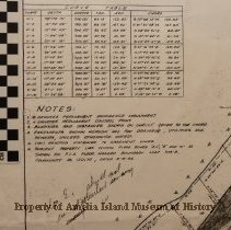
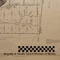
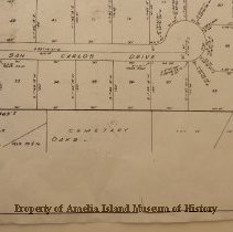
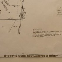
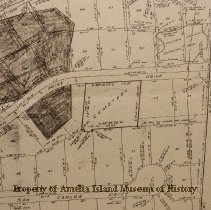
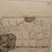
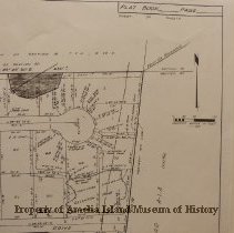
1984 Plat of Plantation Point Subdivision |
Object Name |
Map |
Scope & Content |
This map shows the layout of Plantation Point Subdivision and the shaded areas are where the Indian burials on Amelia Island Plantation (now know as Plantation Point subdivision) known as the Dorion Dig, Florida Master Site # 8N41. Over 175 burials were excavated from the 10 X 17 Meter cemetery area. The dating of the burials 1686 - 1702. |
Object ID |
2009.012.001 |
Collection |
AIMH Maps |
Caption |
1984 Plat of Plantation Point Subdivision |
Number of images |
11 |
People |
Saunders, Rebecca |
Search Terms |
Dorion Dig Harrison Creek Drive |
Subjects |
Maps History Archaeological sites |
Date |
08/15/1984 |