Archive Record
Images
Metadata
Title |
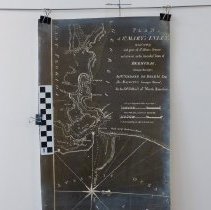
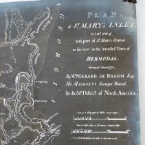
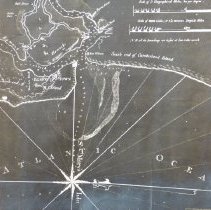
St Mary's Inlet and the intended town of Bermudas |
Object Name |
Map |
Scope & Content |
Photocopy from the Library of Congress taken June 30,1928 of William Gerard De Brahm's 1770 map of St Mary's Inlet and the intended town of Bermudas (now Chester?) 9 miles west of Amelia Island. The map shows 3 islands designated as Tyger Islands, the location of Bells Plantation, Rolfe's Store, M Wrights house and Fort William. |
Object ID |
2013.009.001 |
Collection |
AIMH |
Caption |
St Mary's Inlet and the intened town of Bermudas |
Number of images |
3 |
People |
Bell de Brahm, John William Gerard Rolfe, George |
Search Terms |
Bells Plantation Bermudas Chester Fort William Bells M. Wrights house Rolfe's Store St. Marys, GA |
Subjects |
Maps |
Date |
1770 |