Please fill out this form to request an image and click the Submit Request button when done. The organization will contact you to confirm the details of your request.
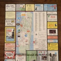
This map was produced by the Florida National Bank in 1980 to advertise the island and island businesses. Copyright Bowden Publications.
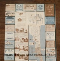
This map shows the north end of Amelia Island beginning at Fort Clinch State Park and continuing southward showing the City Limit to just south of the airport. The reverse shows a Walking or Driving Tour of Centre Street with descriptions of historic homes and buildings and the southern end of the island including Amelia Island Plantation.