Archive Record
Images
Metadata
Title |
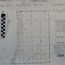
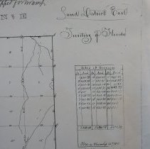
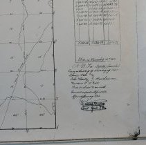
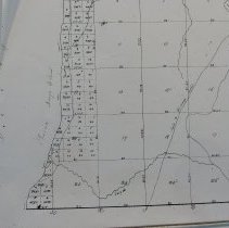
Town 1 N Range 23 E, 1831 |
Object Name |
Map |
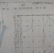
Scope & Content |
Town 1 N (north) Range 23 E (east) (copy) surveyed 4th quarter 1830 by R B Ker, John Handley and David Wells, Chainmen. Drawn 1831. Examined and compared to field notes January 1834 by Robert Butler, Surveyor General of Florida. Shows road to St Marys, GA. |
Object ID |
2013.021.003 |
Collection |
AIMH |
Caption |
Town 1 N Range 23 E, 1831 |
Number of images |
5 |
People |
Butler, Robert Handley, John Ker, R. B. Wells, David |
Search Terms |
Surveyed plats St. Marys River |
Subjects |
Maps Historic site Plats Surveying |
Date |
1831 |