Archive Record
Images
Metadata
Title |
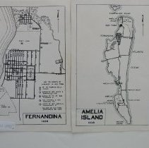
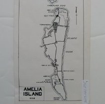
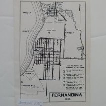
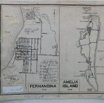
1938 Map of Amelia Island and Fernandina |
Object Name |
Map |
Scope & Content |
A 1938 map of Amelia Island and Fernandina, with key points of Old Town noted. This is composed of 3 maps and all have a notation to page 64 (?) Not to scale |
Object ID |
2013.021.077 |
Collection |
AIMH Maps |
Caption |
1938 Map of Amelia Island and Fernandina |
Number of images |
4 |
Search Terms |
Amelia City Amelia River American Beach Atlantic Avenue Central Park Cumberland Island, GA Cumberland Sound Egan's Creek Fernandina Fernandina Pulp and Paper Co. Fort Clinch FranklintownNassau Sound Kraft Corporation of America Old Town Walkers Landing |
Subjects |
Maps Cities & towns |
Date |
1938 |