Archive Record
Images
Additional Images [8]
Metadata
Title |
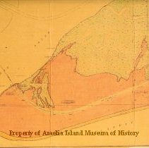
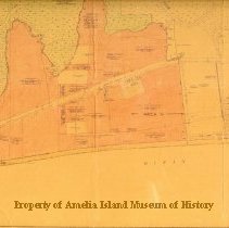
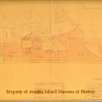
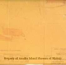
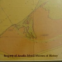
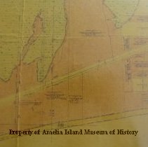
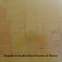
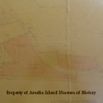
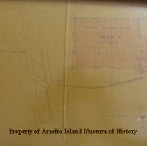
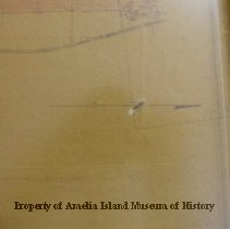
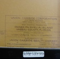
Land owned by Union Carbide Corporation, Amelia Island FL |
Object Name |
Map |
Scope & Content |
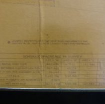
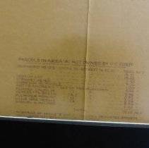
Map of Amelia Island, FL by the Union Carbide Corporation showing the properties owned. 3290.274 Acres. Map dated February 28, 1963, revised April 9, 1963. Former owners who sold land to Union Carbide are listed on the map. Many but not all names are included in this record. |
Object ID |
2018.281.001 |
Collection |
AIMH |
Caption |
Land owned by Union Carbide Corporation, Amelia Island FL |
Number of images |
14 |
People |
Means, Gabriel Pelot, Charles H. Baldwin, R.D. Loeb, James Sanderson, Bessie |
Search Terms |
Afro-American Pension Bureau Amelia River Amelia Road American Beach Fernandina Beach Municipal Airport Florida State Road A1A Franklintown Harrison Creek Lansing Foundation Nassau Sound Ocean Breeze Farms Union Carbide Corporation Walkers Creek |
Subjects |
Surveying Maps |
Date |
1963 |