Archive Record
Images
Metadata
Title |
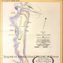
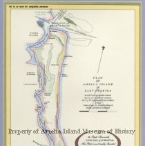
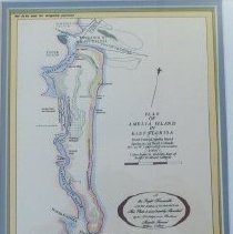
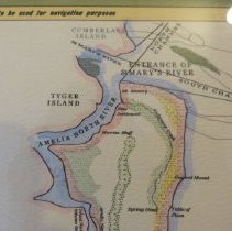
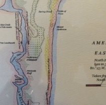
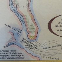
Plan of Amelia Island in East Florida |
Object Name |
Map |
Scope & Content |
Plan of Amelia Island in East Florida Taken from Dr. Brahm's Map of South Carolina & Georgia. To the Right Honourable John Earl of Egmont & Co., This Plate be most humbly Inscribed by his Lordships most Obedient Humble Servant Willm. Fuller. Originally published 26 March 1770 according to Act of Parliament by Thomas Jefferys Geographer to the King in the Strand |
Object ID |
2015.056.001 |
Collection |
AIMH |
Caption |
2015.056.001-2 |
Number of images |
6 |
People |
Fuller, William Egmont, John Perceval Jefferys, Thomas de Brahm, John William Gerard |
Search Terms |
Tyger Island East Florida Nassau River Amelia South River St. Marys River Marsh Island |
Subjects |
Maps Islands |
Date |
1769 |
Year Range from |
1769 |
Year Range to |
1770 |