Archive Record
Images
Additional Images [8]
Metadata
Title |
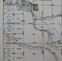
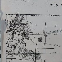
Town 3 N Range 26 E, 1851 |
Object Name |
Map |
Scope & Content |
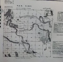
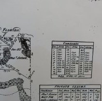
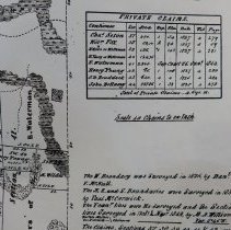
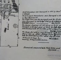
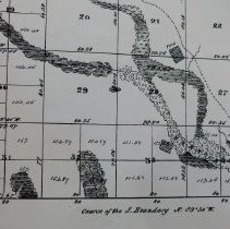
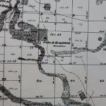
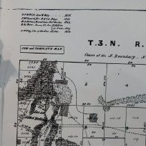
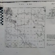
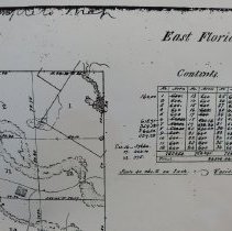
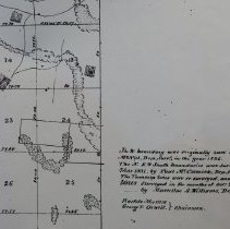
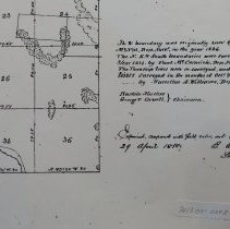
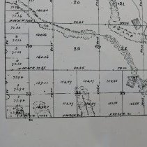
Town 3 N (north) Range 26 E (east) (copy) The West boundary D F McNeil in 1826.The North, East and South boundaries surveyed by Paul McCormick in 1831. Boundaries and Section Lines resurveyed October, November 1849 by Marcellus A Williams with Bartolo Masters and George T Orwell chainmen. Private claims Section 37 - 42 surveyed by D H Burr, 4th quarter 1849. Sections 43 and 44 2nd quarter 1850 by Alexander McKay with Charles Porpall, Joseph Papy, John Darling, and Joseph Higginbotham chainmen. Examined and approved by Benjamin A Putnam Surveyor General April 29, 1850. Private Claims by Section: Charles Seton 37 William Fox 38 N Wildes and E Waterman 39 H Young and E Waterman 40 E Waterman 41 Henry Young 42 John D Braddock 43 John Bellamy 44 |
Object ID |
2013.021.024 |
Collection |
AIMH Maps |
Caption |
Town 3 N Range 26 E, 1851 |
Number of images |
14 |
People |
McNeil, D F McCormick, Paul Williams, Marcellus A. Masters, Bartole Orwell, George T. Burr, D. H. Norris, R W Putnam, Benjamin A. Seton, Charles Waterman, E Porpall, Charles Papy, Joseph Darling, John Higginbotham, Joseph Yonge, Henry Fox, William Wildes, Nathaniel Braddock, John David Bellamy, John |
Search Terms |
Surveyed plats |
Subjects |
Maps Plats Surveying |
Date |
1851 |