Search Term Record
Metadata
Name |
Aerial photo |
Number of Archive records |
3 |
Number of Object records |
0 |
Number of Library records |
0 |
Number of Photo records |
13 |
Related Records
-
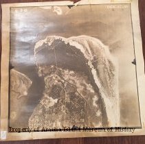
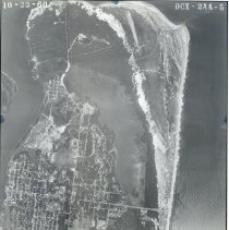
1943 Aerial Photo of Amelia Island - Photograph, Black-and-White
This is one of three aerial photographs dated 6/2/1943. They can be arranged to make a continuous image. See 1992.030.003 and 1992.030.008. The photo is labeled DCX-1C-77 and stamped RESTRICTED. On the reverse a stamp reads: This photograph contains information affecting the National Defense of the United States within the meaning of the Espionage Act, 50 U.S. C. 31 and 32, amended. Its transmission or the revelation of itcontents in any man...
Record Type: Photo
-
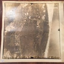
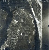
1943 Aerial Photo of Amelia Island - Photograph, Black-and-White
This is one of three aerial photographs dated 6/2/1943. They can be arranged to make a continuous image. See 1992.030.002 and 1992.030.008. The photo is labeled DCX-1C-75 and stamped CONFIDENTIAL. On the reverse a stamp reads: This photograph contains information affecting the National Defense of the United States within the meaning of the Espionage Act, 50 U.S. C. 31 and 32, amended. Its transmission or the revelation of itcontents in any m...
Record Type: Photo
-
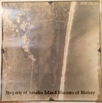
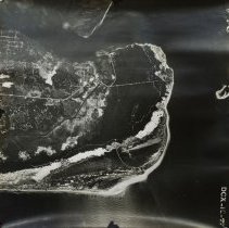
1943 Aerial Photo of Amelia Island - Photograph, Black-and-White
This is one of three aerial photographs dated 6/2/1943. They can be arranged to make a continuous image. See 1992.030.002 and 1992.030.003. The photo is labeled DCX-1C-73 and stamped RESTRICTED. #6 Well and #8 Well have been marked in pen along Eigth Street. Two lots at the eastern edge of the photo are squared in pen. There is an area that appears to be trees planted in rows like an orchard. On the reverse a stamp reads: This photograph con...
Record Type: Photo
-
1974 Aerial photograph of the north end of Amelia Island FL - Photograph, Black-and-White
Record Type: Archive
-
-
Aerial Beach--Main Aerial Beach--Main - Photograph
Aerial Beach--Main This collection of photos was donated by the Fernandina News Leader from images submitted for publication for the newspaper.
Record Type: Photo
-
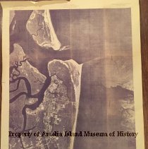
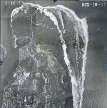
Aerial Map of Egans Creek/ North End of Fernandina Beach taken in 1953. - Photograph
Framed Aerial map of North Fernandina. Egans Creek/ North End taken in 1953.
Record Type: Photo
-
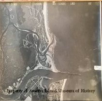
Aerial Map of Egans Creek/ North End of Fernandina Beach taken in 1960 - Photograph
Framed Aerial map of North Fernandina. Egans Creek/ North End taken in 1960
Record Type: Photo
-
Aerial Map of North Fernandina taken in 1943 - Photograph
Framed Aerial map of North Fernandina. Egans Creek/ North End taken in 1943
Record Type: Photo
-
-
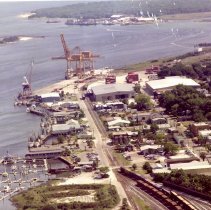
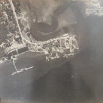
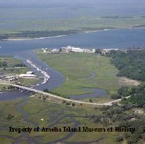
Aerial Photograph of Amelia Island - Photograph, Black-and-White
Black-and-White aerial view of a section of Amelia Island, showing the coast and a port or docks.
Record Type: Photo
-
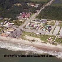
Aerial Pogy Plant Aerial Beach--Main - Photograph
Aerial Pogy Plant This collection of photos was donated by the Fernandina News Leader from images submitted for publication for the newspaper.
Record Type: Photo
-
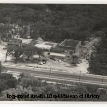
Aerial view Atlantic Recreation Center Construction - Photograph, Black-and-White
An aerial photograph of the construction of the Atlantic Recreation Center in 1955 (approximate).
Record Type: Photo
-
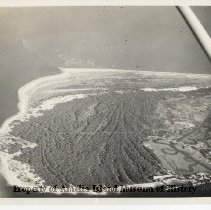
Aerial view north end of Amelia Island. - Photograph, Black-and-White
Aerial view of the north end of Amelia Island. Egan's Creek and Fort Clinch are clearly visible. Old Town and shrimp boats are also visible. Also the north end fishing pier that was destroyed in Hurricane Matthew.
Record Type: Photo
-
Port of Fernandina Beach - Print, Photographic
Aerial Photograph of the Port of Fernandina Beach around 1990.
Record Type: Photo