Search Term Record
Metadata
Name |
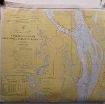
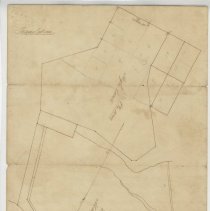
Egans Creek |
Number of Archive records |
4 |
Number of Object records |
0 |
Number of Library records |
0 |
Number of Photo records |
3 |
Related Records
-
-
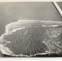
Aerial view north end of Amelia Island. - Photograph, Black-and-White
Aerial view of the north end of Amelia Island. Egan's Creek and Fort Clinch are clearly visible. Old Town and shrimp boats are also visible. Also the north end fishing pier that was destroyed in Hurricane Matthew.
Record Type: Photo
-
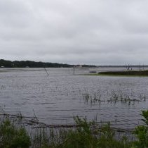
Egans Creek at high tide - Photograph
This photograph was taken on September 27, 2015. It was taken from Atlantic Avenue looking north along Egans Creek. The photo was taken on October 10, 2001. The photo was taken looking north along the Amelia River. It was high tide around 9:30 am.
Record Type: Photo
-
Photo of house on Egans Creek, Atlantic Avenue c. 1925 - Photograph, Black-and-White
Photo of house on Egans Creek, Atlantic Avenue c. 1925
Record Type: Photo

-
-
-
William Hardee (Bill) Kavanaugh Interview - Recording, Audio
Click here to view/hear the file.
Record Type: Archive