Search Term Record
Metadata
Name |
Egan's Creek |
Number of Archive records |
11 |
Number of Object records |
0 |
Number of Library records |
5 |
Number of Photo records |
14 |
Related Records
-
-
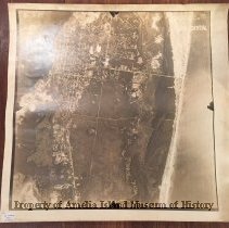
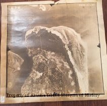
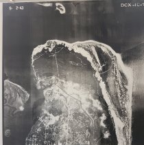
1943 Aerial Photo of Amelia Island - Photograph, Black-and-White
This is one of three aerial photographs dated 6/2/1943. They can be arranged to make a continuous image. See 1992.030.002 and 1992.030.008. The photo is labeled DCX-1C-75 and stamped CONFIDENTIAL. On the reverse a stamp reads: This photograph contains information affecting the National Defense of the United States within the meaning of the Espionage Act, 50 U.S. C. 31 and 32, amended. Its transmission or the revelation of itcontents in any m...
Record Type: Photo
-
1943 Aerial Photo of Amelia Island - Photograph, Black-and-White
This is one of three aerial photographs dated 6/2/1943. They can be arranged to make a continuous image. See 1992.030.003 and 1992.030.008. The photo is labeled DCX-1C-77 and stamped RESTRICTED. On the reverse a stamp reads: This photograph contains information affecting the National Defense of the United States within the meaning of the Espionage Act, 50 U.S. C. 31 and 32, amended. Its transmission or the revelation of itcontents in any man...
Record Type: Photo
-
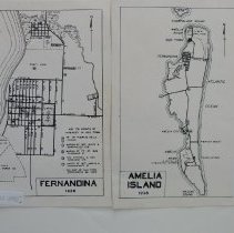
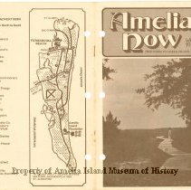
1977-1978 Winter Amelia Now - Magazine
Magazine originally published in 1975 by Helen Litrico as a guide to visitors to Amelia Island, FL. Contains various historical articles, advertisements, and photos.
Record Type: Library
-
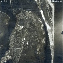
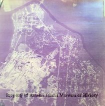
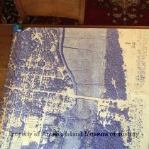
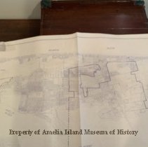
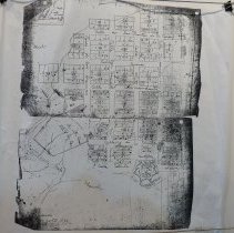
Aerial Map of Egans Creek/ North End of Fernandina Beach taken in 1953. - Photograph
Framed Aerial map of North Fernandina. Egans Creek/ North End taken in 1953.
Record Type: Photo
-
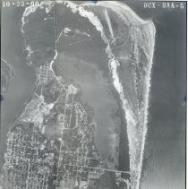
Aerial Map of Egans Creek/ North End of Fernandina Beach taken in 1960 - Photograph
Framed Aerial map of North Fernandina. Egans Creek/ North End taken in 1960
Record Type: Photo
-
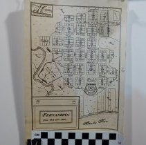
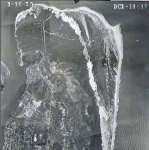
Aerial Map of North Fernandina taken in 1943 - Photograph
Framed Aerial map of North Fernandina. Egans Creek/ North End taken in 1943
Record Type: Photo
-
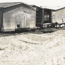
Aerial Photograph of North end of Amelia Island - Photograph, Black-and-White
Aerial Photograph of Fernandina Beach. Downtown north of Centre to Fort Clinch and to Atlantic Ocean
Record Type: Photo
-
-
-
Aerial Photos (46) of Amelia Island taken by Gene Lasserre, approx.1998. - Print, Photographic
Aerial photos of various Amelia Island locations taken (?) by Gene Lasserre from a private aircraft. As one of the photos may be the construction of the new Nassau Sound Bridge, the approximate date for the photos would be 1997-1998. Aerial Photos include: 1 - 7 photos of small aircraft and individuals, including (assumed) Gene Lasserre & his wife, Joan. Lasserre would have been approximately 77 at the time. 8 - 11 photos of paper mills ...
Record Type: Photo

-
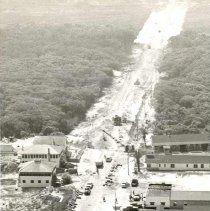
Aerial View of Atlantic Ave. at Fletcher - Print, Photographic
Aerial view of the intersection of Atlantic Ave. and Fletcher with Egan's Creek at top of photo. House on left foreground is the home of the William Green family. House in middle on left is the home of the Rogers family. Motel in right foreground is the the Golden Isle, owned by the Moore Family. Middle building is the Gulf Gas Station, owned by the Gordon Family. The motel at the back right of photo is the Oceanview Motel.
Record Type: Photo
-
A Wonderful World - Book
"A Wonderful World" Book containing photographs by Stephan R. Leimberg of the birds and natural history around Fernandina Beach, FL
Record Type: Library

-
Birds of Amelia - Book
"Birds of Amelia" Book containing photographs by Stephan R. Leimberg of the birds and natural history around Fernandina Beach, FL
Record Type: Library

-
Birds of Amelia II - Book
"Birds of Amelia" Book containing photographs by Stephan R. Leimberg of the birds and natural history around Fernandina Beach, FL
Record Type: Library

-
-
-
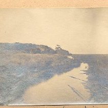
Egans Creek looking north from the bridge - Print, Photographic
Egan's Creek looking north from the bridge
Record Type: Photo
-
-