Search Term Record
Metadata
Name |
Old Town |
Number of Archive records |
148 |
Number of Object records |
22 |
Number of Library records |
20 |
Number of Photo records |
61 |
Related Records
-
-
-
-
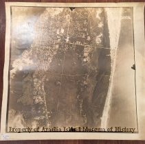
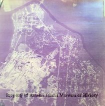
1943 Aerial Photo of Amelia Island - Photograph, Black-and-White
This is one of three aerial photographs dated 6/2/1943. They can be arranged to make a continuous image. See 1992.030.002 and 1992.030.008. The photo is labeled DCX-1C-75 and stamped CONFIDENTIAL. On the reverse a stamp reads: This photograph contains information affecting the National Defense of the United States within the meaning of the Espionage Act, 50 U.S. C. 31 and 32, amended. Its transmission or the revelation of itcontents in any m...
Record Type: Photo
-
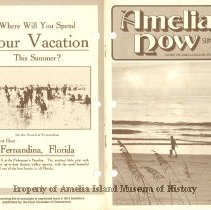
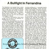
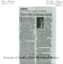
1977 Summer Amelia Now - Magazine
Magazine originally published in 1975 by Helen Litrico as a guide to visitors to Amelia Island, FL. Contains various historical articles, advertisements, and photos.
Record Type: Library
-
1984 Summer Amelia Now - Magazine
Magazine originally published in 1975 by Helen Litrico as a guide to visitors to Amelia Island, FL. Contains various historical articles, advertisements, and photos.
Record Type: Library
-
1987 - 1988 Winter Amelia Now - Magazine
Magazine originally published in 1975 by Helen Litrico as a guide to visitors to Amelia Island, FL. Contains various historical articles, advertisements, and photos.
Record Type: Library

-
2009-2010 Winter Amelia Now - Magazine
Magazine originally published in 1975 by Helen Litrico as a guide to visitors to Amelia Island, FL. Contains various historical articles, advertisements, and photos.
Record Type: Library

-
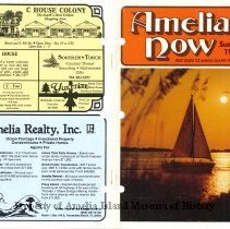
2011 Spring Amelia Now - Magazine
Magazine originally published in 1975 by Helen Litrico as a guide to visitors to Amelia Island, FL. Contains various historical articles, advertisements, and photos.
Record Type: Library

-
-
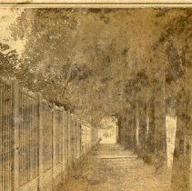
A collection of photographs and postcards from Fernandina Beach - Postcard, Picture
A collection of sepia photographs of houses in Fernandina. Image 2 shows Riddell home on North Fifth Street between Broome and Alachua and the home of J. J. Vaughn Image 5 is the Mansion House with a tent in front. Image 6 is of the R. R. Office Fernandina 1869
Record Type: Photo
-
-
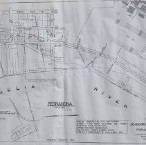
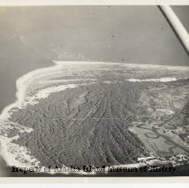
Aerial view north end of Amelia Island. - Photograph, Black-and-White
Aerial view of the north end of Amelia Island. Egan's Creek and Fort Clinch are clearly visible. Old Town and shrimp boats are also visible. Also the north end fishing pier that was destroyed in Hurricane Matthew.
Record Type: Photo
-
-

-
-
-
-

-