Search Term Record
Metadata
Name |
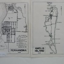
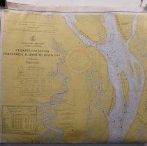
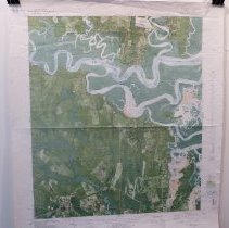
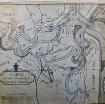
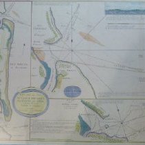
Amelia River |
Number of Archive records |
28 |
Number of Object records |
1 |
Number of Library records |
3 |
Number of Photo records |
24 |
Related Records
-
-
-
-
-
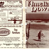
1982 - 1983 Winter Amelia Now - Magazine
Magazine originally published in 1975 by Helen Litrico as a guide to visitors to Amelia Island, FL. Contains various historical articles, advertisements, and photos.
Record Type: Library
-
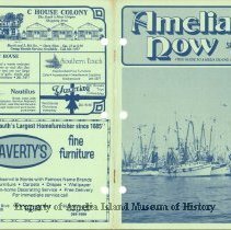
1982 Spring Amelia Now - Magazine
Magazine originally published in 1975 by Helen Litrico as a guide to visitors to Amelia Island, FL. Contains various historical articles, advertisements, and photos.
Record Type: Library
-
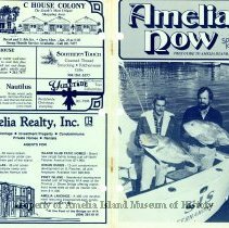
1983 Spring Amelia Now - Magazine
Magazine originally published in 1975 by Helen Litrico as a guide to visitors to Amelia Island, FL. Contains various historical articles, advertisements, and photos.
Record Type: Library
-
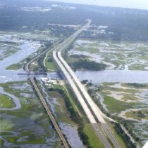
Aerial photograph of bridges of Amelia Island - Print, Photographic
Aerial photographs of Amelia Island taken in August 2008 by Cara Curtin. Pilot was Andrew Curtin. Bridges of Amelia Island: Thomas J. Shave Bridge (over the Amelia River/Intracoastal Waterway) Nassau Sound Bridge with George Crady Fishing Pier North 14th Street Bridge
Record Type: Photo
-
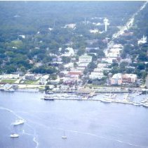
Aerial photograph of Fernandina waterfront - Print, Photographic
Aerial photographs of Amelia Island taken in August 2008 by Cara Curtin. Pilot was Andrew Curtin.
Record Type: Photo
-
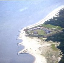
Aerial photograph of Fort Clinch on north end of Amelia Island - Print, Photographic
Aerial photographs of Amelia Island taken in August 2008 by Cara Curtin. Pilot was Andrew Curtin.
Record Type: Photo
-
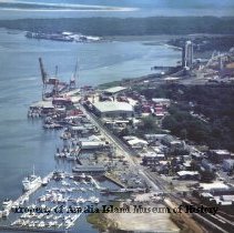
Aerial photograph of the Fernandina Beach Riverfront/Waterfront - Photograph
Aerial photograph of the Fernandina Beach Riverfront/Waterfront area. Visible are Brett's Waterway Cafe, The Train Depot Building, Shrimp boats and other shipping related structures. Photo porvided by David Cook to Jacob Platt.
Record Type: Photo
-
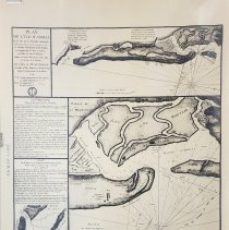
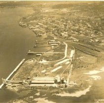
Aerial view of Fernandina before pulp mills - Print, Photographic
Aerial view of Fernandina and Amelia River before pulp mills
Record Type: Photo
-
-
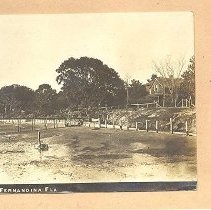
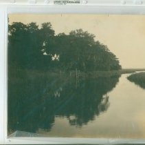
Amelia River--north end - Print, Photographic
Looking along the quiet salt waters of the Amelia River (north end of Amelia Island) where the oyster beds lie.
Record Type: Photo
-
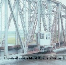
Bridge for train over Amelia River - Photograph
Bridge for train over Amelia River This collection of photos was donated by the Fernandina News Leader from images submitted for publication for the newspaper.
Record Type: Photo
-
Brien Laing Interview with: Mamie Delaney - Recording, Audio
Click here to listen to this interview.
Record Type: Archive

-
-
-
-